The long and troubled task
of
Finding "The
Longitude"
| "War
is chaos and
the American Army practices chaos on a daily basis."
unknown
German Officer
|
D Vautier
6/2019
 Travelers
who finally ventured by sea beyond the Mediterranean soon found out that
the earth was really big and a ship could easily get lost. By 1500
mariners had worked out a number of reasonable ways to determine
latitude using the astrolabe and cross staff.
By measuring the height of the sun and applying a rough estimate
of declination they
could compute latitude. Mariners then had to used dead reckoning, the
stars, the sun, coast lines, log-ships, wind speeds, and currents to
help them find a rough longitude but it remained a continuing and troubling
mystery for a long time.
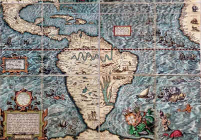
Maps continued to contain areas of dragons and sea serpents.
Travelers
who finally ventured by sea beyond the Mediterranean soon found out that
the earth was really big and a ship could easily get lost. By 1500
mariners had worked out a number of reasonable ways to determine
latitude using the astrolabe and cross staff.
By measuring the height of the sun and applying a rough estimate
of declination they
could compute latitude. Mariners then had to used dead reckoning, the
stars, the sun, coast lines, log-ships, wind speeds, and currents to
help them find a rough longitude but it remained a continuing and troubling
mystery for a long time.
Maps continued to contain areas of dragons and sea serpents.
Real
worldwide exploration was said to have begun at the end of the 1400s
and rapidly increased after that. This sudden increase in ocean going
discovery brought along with it all the accidents
which were most likely to happen in uncharted waters and with such poor
navigational aids and few accurate maps. It was especially bad because sailors had little idea
of where the dangers were. When
they ran into shoals or rocks there was no way to chart them and to warn
others. Things were even
worse with the smaller caravels that were never designed for the rigors of
open ocean travel and were mercilessly subjected to the harsh abuses of
ocean storms, long
periods at sea and calms. Full oceans were a lot bigger by far then the
familiar old Mare Nostrum.
The first notable ocean traveler was Bartolomeu
Dias who sailed around
South Africa
but did not know what he had done until on his way back he was able to
recognize the Cape of Good Hope. Of
course 4 years later Columbus
easily followed the latitude and got to America.
It was said that he did bring an astrolabe and a cross
staff. A few years later in 1498
Vasco Da Gama took three ships and was able to get to India
based on maps created by Dias. He
did it by good seamanship, luck, and following the coast. Also the only
instruments he took were the astrolabe, the ship-log and the cross
staff.
Astronomers gradually developed better ways to find
latitude with higher quality cross staffs and back staffs, more accurate
declination tables and eventually fine
instruments such as octants and sextants, but for almost 400 years after
Columbus, longitude remained an unsolvable mystery. This period lasted from the beginning of full ocean exploration
by Dias in 1488 until into the 1800s. The almost mystical quest for “the longitude” became
synonymous with griffins, unicorns, sea serpents and philosophers’
stones. It was truly the stuff of
legends and folklore, a superstition, a joke, a funny and humorous unattainable goal to all
including astronomers and scientists alike. The great Newton
himself said it was unsolvable.
.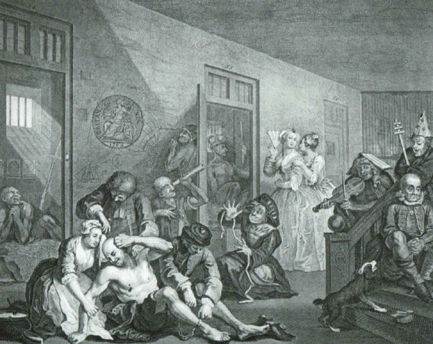
- this lithograph scene is from Hogarth.
Notice insane man looking for the longitude (Cronin, 20).
But ships continued to be lost to uncharted waters
and mysterious forces. Sea maps
continued to contain unknown areas marked simply as “here be dragons”.
Spain,
England, Portugal, Holland
and France had large navies and all desperately needing better sea maps.
In 1598 Philip III of
Spain
offered a reward of 100,000 crowns to anyone who could solve “the
longitude” (Milner, 261). The
States-General of Holland soon offered 10,000 florins for a solution.
These large rewards in cash brought interest from noted
astronomers and scientists such as Huygens and Hooke but everybody soon lost
interest as the task appeared unsolvable under their existing technology.
By 1700, more than a hundred years later, the problem was still
nowhere closer to a solution. Unworkable
and crazy ideas were offered such as the chained-ship theory and the
wounded dog theory. In
desperation the authors of the chained-ship theory published and printed
articles and pamphlets thereby gaining so much attention
and notoriety that the merchants of
London
demanded Parliament to do something about it. So in 1714 the British government finally signed into law the Longitude
Act
which offered generous cash awards for basic research and
development to help solve the longitude problem.
It is no understatement to suggest that the longitude Act of 1714 represented one of the most successful
peacetime efforts on the part of any government anywhere to foster the
development of basic research in astronomy, science and precision watch-making.
During the course of it’s existence the Board of Longitude
distributed over £100,000 to many worthy projects.
Scientists laid the groundwork for the
establishment of a prime meridian somewhere on earth that represented
longitude 0. Then they could measure everything east or
west of that line in hours, minutes, and seconds using the sun or moon as it
went overhead. This was no
easy task with a sun moving over the earth so fast. At sea it was not
quite as critical since the time could be off 30 seconds and land could
still be visible but just to get 30 second accuracy was neigh impossible
at that time.
So just where to set the prime meridian depended on which country was the strongest sea power or who had the best
scientists or who could develop the best techniques. The prime meridian was moved several times but eventually wound up at Greenwich,
England even though
France
continued to claim Paris for many years.
Since the establishment of the Royal Observatory
at Greenwich in 1675, the race was on between the astronomers and the
watch-makers or “mechanics”. The astronomers felt that the longitude could be solved by
use of the moon and stars. The "mechanics" felt that an accurate sea clock could be made.
Lunar-Distance method
But
astronomers were determined to solve the longitude problem by the
measurement of lunar distances from key stars at different times of the
month. John Flamsteed was
appointed the first Astronomer Royal at the
Greenwich Observatory and his goal was to compile a catalog of stars and their
locations in relation to the moon. Flamsteed
labored at this job for almost 50 years and never completed it. In 1725 the lunar tables were finally published. They were not really
complete until Tobias Meyer of Germany
finished them (sort of) in 1755 (Cronin, 16). To get longitude three simultaneous angles were required, one
from moon to star, star to horizon, and moon to horizon. Hence it required three skilled sailors and a clear night sky.
The lunar-distance method was proven to be fairly accurate to about ½
degree by Nevil
Maskelyne who succeeded Flamsteed as
England’s Royal Astronomer from 1765-1811.
There
were many other calculations needed to get this procedure to work
dealing with atmosphere, temperature. The
calculations could take up to four hours. Any
mistake along the way would render the reading incorrect.
The
lunar-distance method was not easy.
Chronometer method
The chronometer finally began to
become a reality when John Harrison came to
London. Under his leadership and inspiration a host of other clock-makers
developed sea clocks that eventually proved inexpensive enough so that
almost all English vessels were equipped with them.
With a good chronometer finding longitude turned out to be incredibly
simple. The most critical part was determining within a fraction of a
second when the sun passes over the local time meridian, that is when the sun is highest in the sky.
After
all the sun is raging over the earth at almost a mile a second so each
second represents about a mile. Actually
it’s 1.1 miles at the equator and less as you go north. I suspect that there could have been two or three sextant
shooters and possibly two or three sea clocks on board any one of the
earlier seagoing ships.
Once the time of sun transit is recorded
to the second, then
the equation-of-time is added, the
result being longitude.