The
Nootka Affair
| "Naught
was heard on board but expressions of delight"
George Vancouver, (Bown, 125) |
Dominic
Vautier
9/17/18
 In
the latter part of the 1700s there were no less than four countries that had
strong interests in the northwest part of North America. Abundant opportunities lay in exploring, trading, determining fishing
rights, and establishing fir trading settlements. It was a country rich in sea
otter, beaver and foxes, thick abundant forests, lakes, fresh water and
excellent soil. It was mostly unclaimed land, or I should say correctly, claimed
by everybody that came there that wanted to claim it, ignoring the idea it was
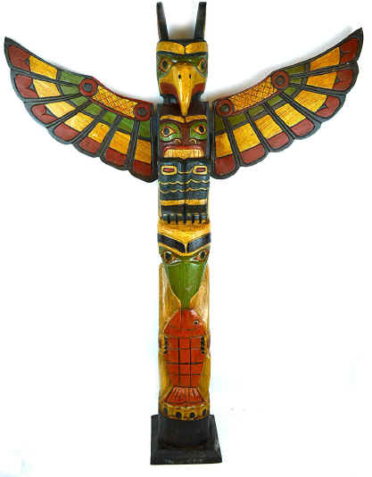
already long occupied by many indigenous peoples. The Spanish had made several early explorations along the coast of
northern California, and sailed up the west coast of North America discovering the Straight of Juan
de Fuca, the entrance to Puget Sound and the much larger straight of
Georgia
as well as many if the smaller islands just inland from the straight itself.
Soon after that the British sent a scientific expedition under the
leadership of George Vancouver to seek out the mysterious and illusive
Northwest Passage, but more likely intending to claim land and investigate the practicality of
fir trading settlements and the ability to establish trade with the Indians.
There were also the Russians coming from the west and north that sent a
number of independent traders and began to map and occupy portions of Alaska.
Late to the scene were the
Americans who had only a few ventures there, one Robert Gray for example, who
was simply trading firs and accidentally stumbled upon some discoveries along
the way, such as the
Columbia River
and Gray’s Harbor.
In
the latter part of the 1700s there were no less than four countries that had
strong interests in the northwest part of North America. Abundant opportunities lay in exploring, trading, determining fishing
rights, and establishing fir trading settlements. It was a country rich in sea
otter, beaver and foxes, thick abundant forests, lakes, fresh water and
excellent soil. It was mostly unclaimed land, or I should say correctly, claimed
by everybody that came there that wanted to claim it, ignoring the idea it was
already long occupied by many indigenous peoples. The Spanish had made several early explorations along the coast of
northern California, and sailed up the west coast of North America discovering the Straight of Juan
de Fuca, the entrance to Puget Sound and the much larger straight of
Georgia
as well as many if the smaller islands just inland from the straight itself.
Soon after that the British sent a scientific expedition under the
leadership of George Vancouver to seek out the mysterious and illusive
Northwest Passage, but more likely intending to claim land and investigate the practicality of
fir trading settlements and the ability to establish trade with the Indians.
There were also the Russians coming from the west and north that sent a
number of independent traders and began to map and occupy portions of Alaska.
Late to the scene were the
Americans who had only a few ventures there, one Robert Gray for example, who
was simply trading firs and accidentally stumbled upon some discoveries along
the way, such as the
Columbia River
and Gray’s Harbor.
The straight of
Juan de Fuca, also called the straight of Anian by the British, referred to the
entrance to Puget Sound and the much larger straight of
Georgia lying just to the north. It was
first discovered by the Spanish in the 1770s but they were not very aggressive
in mapping the region. Early voyages
by Francisco Elisa and Manual Quimper under the command of Bodega y Quadra crept along the British Columbian coast
naming the
San Juan Islands. But it turns out they were quite
unwilling to venture down beyond Admiralty Inlet to the south which seemed
of little value and obviously did not hold any prospect for a
Northwest Passage
(Bown, 25). Besides the area past
Admiralty Inlet
contained many obstacles, snags and sand bars, an apparent useless snarl of
rocks and coves, and appeared to present no possibility of good harbor.
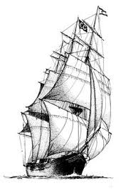 Captain
Cook made an attempt to sail into the straight but was so severely hampered by
storms that he turned back. His
first mate remarked that the place should be called the “Straight of Wanna
Puka” (Horowitz, 32). Besides, Cook's mission was the exploration of
Alaska
and the discovery of the Northwest Passage. Some years later Captain Vancouver
was sent on a purely scientific mission to map precisely the northwest coast of
America. He was a meticulous man and spent
a full two years from 1794 to 1796 carefully mapping the Puget Sound area in much
detail as well as laying English claim to just about everything he found (Bown,
130). Justly so, He left an
abundance of English place names;
Bellingham, Everett, Gardner Bay, Elliott Bay, Whidbey Island, Mount Baker and of course Puget Sound
itself in honor of Peter Puget. A few years later Alexander
Mackenzie came overland from
Canada
exploring much of the area around
British Columbia
and the Fraser River. This happened more than 10 years
before Lewis and Clark
even appeared, and they had no mission there other than one of observation.
Captain
Cook made an attempt to sail into the straight but was so severely hampered by
storms that he turned back. His
first mate remarked that the place should be called the “Straight of Wanna
Puka” (Horowitz, 32). Besides, Cook's mission was the exploration of
Alaska
and the discovery of the Northwest Passage. Some years later Captain Vancouver
was sent on a purely scientific mission to map precisely the northwest coast of
America. He was a meticulous man and spent
a full two years from 1794 to 1796 carefully mapping the Puget Sound area in much
detail as well as laying English claim to just about everything he found (Bown,
130). Justly so, He left an
abundance of English place names;
Bellingham, Everett, Gardner Bay, Elliott Bay, Whidbey Island, Mount Baker and of course Puget Sound
itself in honor of Peter Puget. A few years later Alexander
Mackenzie came overland from
Canada
exploring much of the area around
British Columbia
and the Fraser River. This happened more than 10 years
before Lewis and Clark
even appeared, and they had no mission there other than one of observation.
Nootka Bay
is a fairly insignificant spot on the western side of
Vancouver Island. Not much is there today, just a
few vacation cabins and some stores but it wasn’t always like that. In the 1780s it was a bustling port used by all comers to trade furs with
the local Indians and for refitting ships (Bown, 62). Explorers used the port frequently to refit for the hazardous trip north
to Alaska
and northern Canada and to gather provisions. In practice it was considered an
“open port” but the Spanish had a way different idea.
Spain had long since been in the
habit of laying preposterous claim to vast territories. Balboa who discovered the Pacific Ocean boastfully proclaimed complete
ownership of that ocean and all the shores it touched, somewhat a flight of
imagination but actually a concept believed and followed by Spain. Spain
did not consider any port “open” especially Nootka since they were the
first to discover it so no other nation had any right to be there. This credo of mare clausum (Bown, 80) had long been a sore sport to other
seafaring countries who believed that it was a common practice and accepted
courtesy that all ports should be open or considered mare liberum to any and all
nations except in time of war.
In
1789 captain Martinez
sailed north with orders to re-establish control of Nootka harbor. Upon his
arrival he captured several British ships at anchor and sent them south to San
Blas loaded with British prisoners. This
whole incident sparked a much larger issue about “open” ports. To the British, Russians and Americans all ports were open to other
nations and it was a good time to teach the Spanish a lesson about freedom of
passage and world trade.
By
1790 word of the nefarious Spanish action had finally trickled into London and the Crown was furious, demanding return of all citizens and compensation
for such an ignominious breach of national propriety. The Spanish refused to deal continuing to claim their exclusive port
rights. By April of that year (Bown,
78) the British began mobilization of its fleet, impressment of all available
sailors, and increase production of war materials.
Spain, realizing its total vulnerability turned to France
for help.
France was in the early stages of revolution and declined. Moreover the Dutch and Prussia, after years of continuing annoyance threw in with the British.
Spain, realizing that any war against such odds was hopeless, went to the bargaining
table. This resulted in the Nootka Sound Convention which basically established
that all ports were “open” ports. It
also virtually excluded Spain from all further activity in the northwest unofficially limiting them to 40
degrees north latitude. Although the
United States
did not take part in the treaty, our country profited greatly because the
majority of ships trading in the area after 1790 were American.
It was
well over 30 years later that president John Quincy Adams negotiated a boundary
change with
Great Britain
extending the 49th parallel to the Rocky Mountains.
Later, he was also able to deal favorably
with the Russians in 1824 and set the southern boundary of Alaskan expansion at
54 degrees 40 minutes, thus excluding that country from any further involvement
in the
Oregon
Territory. At the same time the Adams-Onis treaty with Spain once and for all set the
southern boundary of the Oregon territory at 42 degrees north, which is the
present north boundary of California, thus also excluding any Spanish
involvement whatsoever north of that latitude (Borneman, 155). It is unlikely that Spain
really cared one way or the other about Adams-Onis because they had been in an
11 year civil war with Mexico for independence which lasted from 1810 to
1821, a long and drawn-out war. Whatever input Mexico
had at the time remains to be seen. When Mexico finally won its independence it was probably too weak to do much about its
northern border.
By
1825 the Oregon Territory was clearly defined and well mapped, bounded on the north by 54 degrees 40
minutes, on the south by the 42nd parallel, on the east by the
continental divide and on the west by the ocean.
The Oregon
territory was therefore claimed by only two countries, Britain
and America. Albert Gallatin, secretary of state under John Quincy Adams had the difficult
job of trying to negotiate some sort of treaty (Borneman, 155). Quincy Adams realized that there were only three really good harbors on
the pacific,
San Francisco,
San Diego, and
Puget Sound. He was not about to give up that
fine northern harbor at any cost, even though the British held firm claim to it.
After a gruesome and destructive war from 1812 to 1815 between the two
countries, neither was much for continuing and extreme alternatives such as another war over
Cascadia so the two countries signed the Anglo-American Convention Treaty of
1818 (Bown, 222) which provided joint occupancy for ten years. Nine years later the treaty was about to expire.
After much more haggling the treaty was then extended and a sort-of joint
occupation was to continue indefinitely, even though British jurisdiction had
been established by that time in the Cascadia region. The
agreement could be terminated at any future time but required either country to
give a one year notice. Their horns
were now locked. Whenever and whoever gave that notice was to introduce
destabilization to the region and could very easily lead to yet another grisly
war.
Seeing
the Elephant