| Carthago delenda est Carthage must be destroyed Julius Caesar |
D Vautier
6/2019
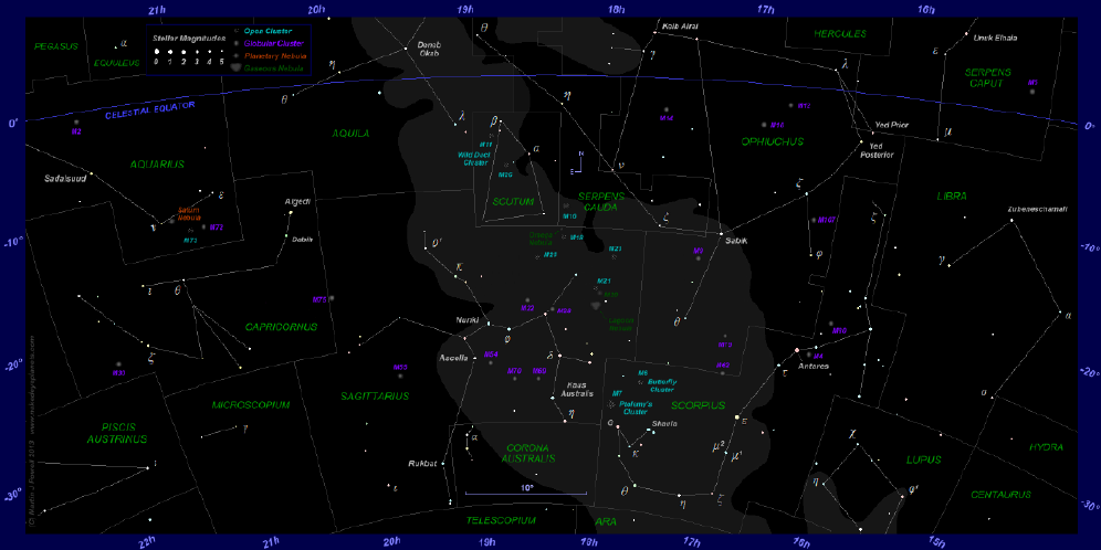
Celestial mapping, that is, the location of heavenly bodies is obviously different from the method used for earth mapping. Celestial latitude, called Declination or Dec, begins at the ecliptic which is a projection of earth’s orbit plane around the sun, not earth’s equator which wanders all over the place. Celestial bodies are measured in declination north and south of this imaginary line in degrees, minutes, seconds and fractions of seconds of arc.
Celestial longitude is called Right Ascension or RA and it is measured in hours, minutes, and seconds of arc up to 24 hours starting left when facing south. RA begins at zero hours at the sun’s position during the spring equinox, the moment the sun crosses the ecliptic going north. The 24 hours of right ascension are measured in sidereal time.
With the exception of local planets, all distant celestial bodies eventually move and the celestial grid will move too as the earth and sun change, but this is all a very slow process. The present method of describing the location of heavenly bodies seems adequate. Astronomers are beginning to use decimal degrees and decimal hours although minutes and seconds are still used.
Soon, hopefully, the decimal system will be adopted instead of the degree, minute, second system now in place just as it has been for earth locations.
|
I |